


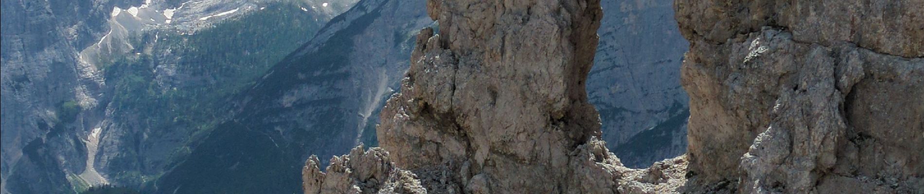
Vallon Popena & Guglia De Amicis

Noiraude
Gebruiker
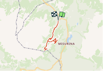

Lengte
13,1 km

Max. hoogte
2246 m

Positief hoogteverschil
770 m
Km-Effort
23 km

Min. hoogte
1666 m

Negatief hoogteverschil
776 m
Boucle
Ja
Datum van aanmaak :
2023-06-29 06:37:47.534
Laatste wijziging :
2023-06-29 16:27:28.004
7h21
Moeilijkheid : Medium

Gratisgps-wandelapplicatie
 SityTrail
IGN / Geografische instituten
SityTrail Plus
De wereld gaat voor u open
Over ons
Tocht Stappen van 13,1 km beschikbaar op Veneto, Belluno, Auronzo di Cadore. Deze tocht wordt voorgesteld door Noiraude.
Foto's


21 fotos in totaal. Klik op een foto om ze allemaal in de galerij weer te geven.
Plaatsbepaling
Land:
Italy
Regio :
Veneto
Departement/Provincie :
Belluno
Gemeente :
Auronzo di Cadore
Locatie:
Unknown
Vertrek:(Dec)
Vertrek:(UTM)
288769 ; 5164132 (33T) N.
Opmerkingen